Table of contents
Syllabus: GS I—Geography: Map projections | GS II—International institutions, India’s interests and sovereignty
1. Why in the news?
On 4 September 2026, the United Nations General Assembly adopted the Togo-led “Correct the Map” resolution, promoting more proportionate representation of the world’s regions, particularly Africa.
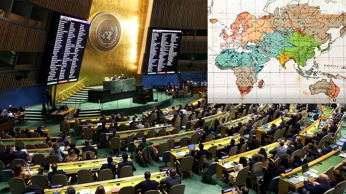
- Voting: 164 in favour, 1 against—the United States—and 6 abstentions.
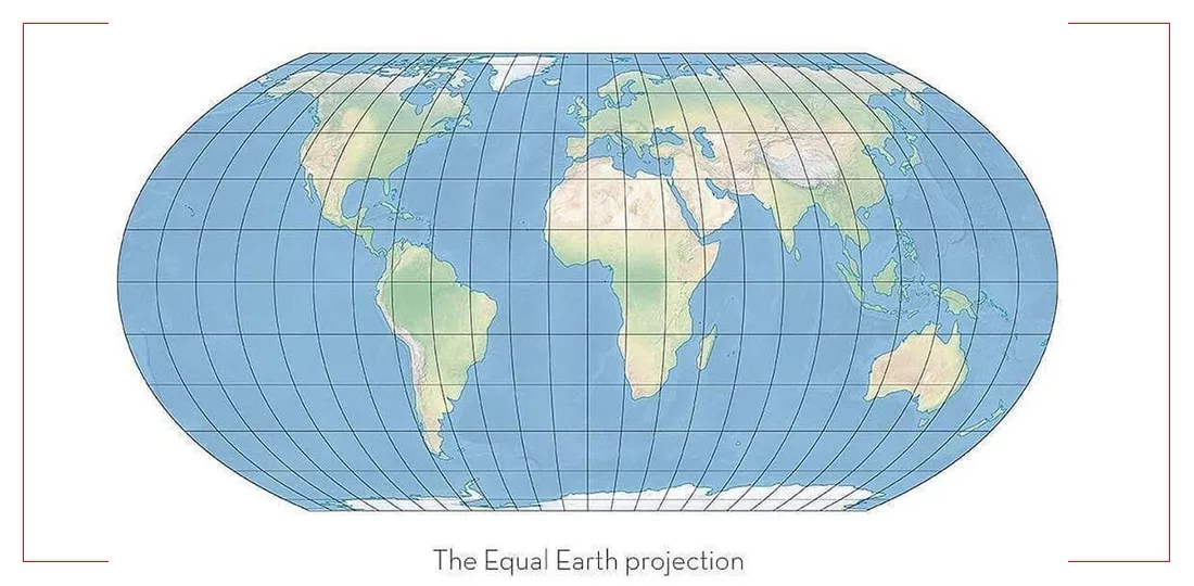
- Encourages wider use of equal-area projections, particularly Equal Earth, where relative continental size matters.
- India supported the resolution while clarifying its interpretation and scope. (press.un.org)
Key distinction: The resolution concerns the representation of geographical area. It does not redraw international boundaries or settle territorial disputes.
2. What is a map projection?
A map projection is a mathematical method of representing Earth’s curved surface on a flat map.
Every flat world map introduces distortion in one or more properties:
- Area
- Shape
- Distance
- Direction
Therefore, a projection must be selected according to the map’s purpose. No flat world map preserves all these properties simultaneously. (pubs.usgs.gov)
3. Mercator versus Equal Earth
| Feature | Mercator projection | Equal Earth projection |
|---|---|---|
| Development | Gerardus Mercator, 1569 | Bojan Šavrič, Tom Patterson and Bernhard Jenny, 2018 |
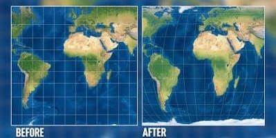
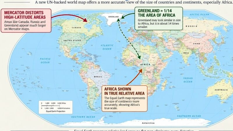
| Main property | Preserves local angles and shapes | Preserves relative areas |
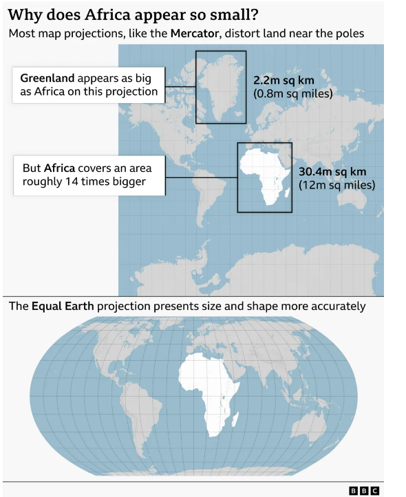
| Appearance | Increasing enlargement towards the poles | Landmasses shown in correct area proportions |
| Main limitation | Distorts relative continental size | Does not preserve all shapes, distances or angles |
| Suitable application | Navigation: constant-bearing routes appear as straight lines | World maps comparing continental and regional areas |
Equal Earth was described in a peer-reviewed article published in 2019. It draws visual inspiration from the Robinson projection but preserves relative areas.
Example: Africa is approximately 14 times larger than Greenland, although the two can appear comparable on a Mercator world map.
4. What does the resolution actually change?
| It promotes | It does not do |
|---|---|
| More accurate comparisons of landmass area | Create a distortion-free world map |
| Greater geographical awareness | Establish new international boundaries |
| Consideration of equal-area maps | Settle sovereignty or territorial disputes |
| Institutional and educational adoption | Require immediate replacement of all navigation maps |
The resolution is non-binding. India stated that its support should be understood as favouring equal-area approaches, rather than endorsing one particular projection or map.
5. Why is it significant?
A. Geographical literacy
- Improves understanding of the relative sizes of continents.
- Helps correct misconceptions caused by using navigation-oriented maps for general education.
- Creates an opportunity to teach the advantages and limitations of different projections.
B. Representation of the Global South
- The initiative places Africa’s geographical representation on the multilateral agenda.
- It raises questions about how familiar visual conventions influence perceptions of regions.
Analytical point: Better geographical representation may influence public understanding, but increased investment or diplomatic power cannot be assumed to follow automatically.
C. Maps and power
Critical cartography studies how maps reflect choices about names, boundaries, emphasis and omission. Harley’s work highlights that maps can communicate institutional and political perspectives alongside geographical information.
Mains linkage: Maps are tools of geographical knowledge and can also shape political narratives.
6. India’s position and the boundary controversy
India’s position
India supported:
- More accurate and representative cartographic practices.
- Equal-area approaches where comparison of landmass sizes is the objective.
- Freedom to select different projections for different applications.
India clarified that its vote did not endorse Equal Earth or any other particular projection.
Arunachal Pradesh and Aksai Chin
Reporting attributed to The Hindu described a UN map dated 1 July 2026 showing competing Indian and Chinese claim lines around Arunachal Pradesh and Aksai Chin. The precise markings were not independently verified in this research.
Important distinction:
- Projection: How Earth’s surface is displayed.
- Political cartography: Which boundaries, claims and names are displayed.
Changing the projection does not itself determine which territorial claim is accepted.
The MEA clarified that the resolution does not authenticate a particular map or address international boundaries and disputed territories. Therefore, India’s vote cannot be treated as acceptance of an adverse boundary depiction.
7. How could it affect us?
| Area | Likely implication |
|---|---|
| Education | Greater use of equal-area world maps and better teaching of projection limitations |
| Media and publishing | Review of maps used to compare countries and continents |
| Research | Greater awareness of choosing projections appropriate to spatial analysis |
| Diplomacy | Continued scrutiny of boundary labels and territorial depictions |
| Everyday navigation | No automatic change merely because of the resolution |
| Sovereignty | No territorial settlement or change created by this measure |
These are potential implementation implications, rather than a confirmed timetable of changes. Official explanations emphasise educational purposes and exclude changes to territorial status.
8. Challenges and way forward
| Challenge | Way forward |
|---|---|
| Headlines conflate projection reform with boundary changes | Clearly distinguish geometry from political cartography |
| Every projection has limitations | Adopt maps suited to their intended purpose |
| Disputed boundaries may be reproduced without context | Use clear legends, attribution and authoritative references |
| Replacing maps alone may not improve understanding | Teach comparative map literacy |
| Symbolic reform may be overstated | Assess educational outcomes rather than assume wider material benefits |
Prelims pointers
- Equal-area ≠ equal-distance.
- Equal-Earth preserves relative area, not every geographical property.
- Mercator’s area distortion increases towards the poles.
- Constant-bearing routes appear as straight lines on Mercator maps.
- The resolution does not settle international boundary disputes.
- India supported the principle of equal-area representation without endorsing a specific projection.
Mains practice question
“Cartographic representation is both a technical choice and a political act.” Discuss in the context of the UN’s ‘Correct the Map’ initiative and India’s concerns. (150 words, 10 marks)
Answer framework: Projection distortions → geographical literacy and Africa’s representation → maps and political narratives → distinction between projection and sovereignty → purpose-appropriate mapping and clear boundary attribution.
Previous Post