Table of contents
News
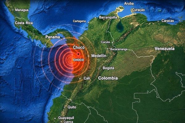
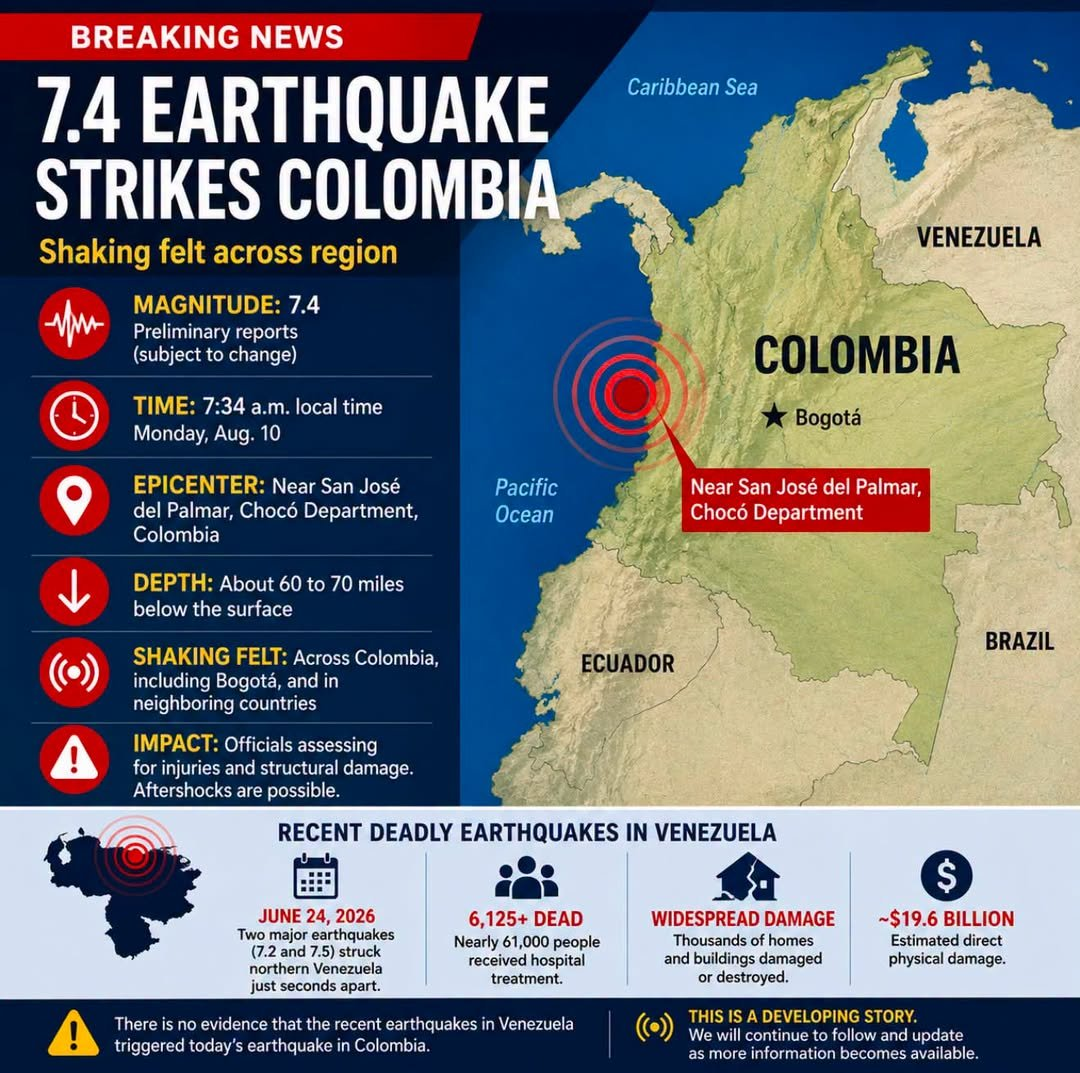
A powerful 7.4-magnitude earthquake struck western Colombia on Monday, August 10, 2026, killing at least 132 people and injuring over 570 others. The earthquake is the strongest recorded in Colombia in the last decade.
Key Details of the Earthquake
- Epicenter: Located near the municipality of San José del Palmar in the Chocó department (about 150 miles west of Bogotá).
- Depth: Roughly 96 to 107 kilometers (60 to 66 miles) deep.
- Impact Area: Felt across nine departments and all 32 provincial capitals. It shook neighboring countries like Venezuela, Ecuador, and Panama.
Geographical Significance
The August 10, 2026, Colombia earthquake is highly significant from a geographical and geological standpoint because it released immense energy from deep beneath the Andes mountains, creating an expansive shockwave that bypassed local crust defenses to shatter populated mountain valleys. Geologists are classifying this event as the most powerful earthquake to hit Colombia in the last decade.
The Epicentre: Hidden in the High Andes
The precise coordinates of the epicentre were recorded by the U.S. Geological Survey (USGS) at 4.903°N and 76.189°W.
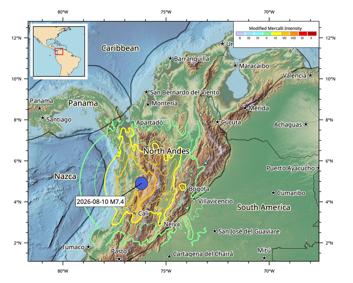
- Location: The quake ruptured approximately 5 kilometres (3 miles) east of San José del Palmar, a small community in the Chocó department.
- Terrain: Geographically, this sits at an elevation of roughly 13,000 feet within the Cordillera Occidental (Western Ranges), the smallest and least populated of the three massive northern branches of the Andes Mountains.
- The Paradox: While the surface epicentre was located in a sparsely populated tropical mountain forest, the geography of the shockwave targeted densely populated urban areas further inland.
Tectonic Architecture: A Triple-Plate Clash
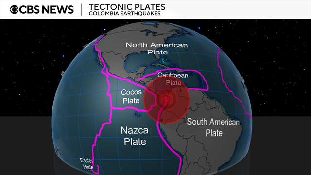
Colombia sits squarely on the Pacific Ring of Fire and features one of the most complex tectonic jigsaw puzzles on Earth. The country is jammed between three massive tectonic plates:
- The Nazca Plate (Oceanic crust moving east from the Pacific)
- The Caribbean Plate (Moving north/east)
- The South American Plate (Continental crust moving west)
Seismologists note that this particular 7.4-magnitude rupture featured a strike-slip motion, meaning the massive plates ground horizontally sideways past one another under extreme pressure.
The Science of the "Deep Focus" Shockwave
The USGS and the Colombian Geological Service (SGC) pinpointed the depth of the rupture between 96 and 107 kilometres (60 to 66 miles) below the Earth's surface. In seismology, this is considered an intermediate-to-deep focus earthquake. The depth created two distinct geographic phenomena:
- The Amplification Effect: Usually, shallow earthquakes focus extreme damage right at the epicenter. Because this event occurred deep below the Earth's crust, the seismic waves traveled upward like a cone. This allowed the energy to bypass the immediate unpopulated surface of Chocó and spread widely, violently shaking the alluvial soil of highly populated valleys like the Coffee Axis (Eje Cafetero) and the Valle del Cauca.
- Low Aftershock Count: Deep-focus quakes release their stress in large, singular shifts. While the SGC recorded roughly 21 initial aftershocks, the threat of continuous, collapsing secondary tremors is lower compared to shallow earthquakes, aiding immediate search and rescue.
Topographical Secondary Risks
Because the shaking tore through the steep, volcanic topography of western Colombia, the geography presents immediate secondary hazards. The region features active stratovolcanoes like Nevado del Ruiz. Seismic shaking at this scale heavily destabilises mountain soil, putting neighbouring high-altitude towns at risk for severe landslides and mudflows, while flight operations at surrounding regional airports remain entirely halted due to high-altitude runways undergoing safety evaluations.
Major Damage and Casualties
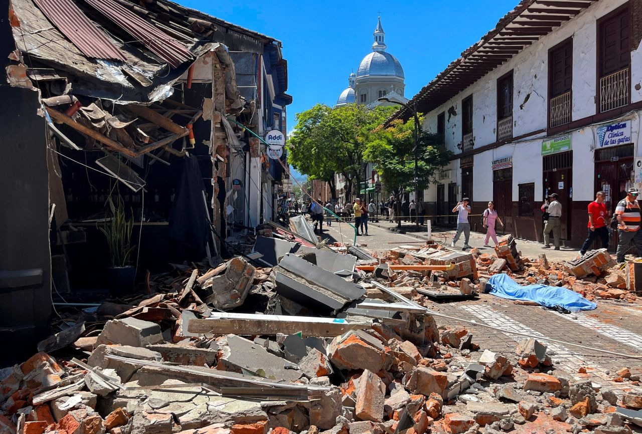
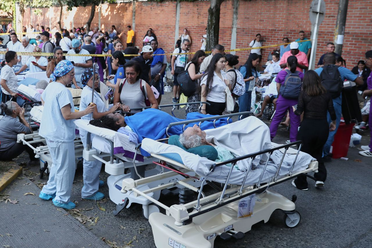
The newly inaugurated Colombian President, Abelardo de la Espriella, has declared a national disaster situation to fast-track rescue funding and emergency capabilities. Over 1,600 buildings have been damaged, including at least 61 that completely collapsed.
- Pereira: One of the hardest-hit urban centers, reporting at least 40 fatalities.
- Cali: Multiple buildings collapsed, including parts of the pediatric and neonatal wings of a local hospital, trapping several patients.
- Manizales: The historical tower of the city's beloved cathedral crumbled during the shaking.
- Infrastructure: Flight operations were entirely suspended at six regional airports—including Pereira, Manizales, Quibdó, Armenia, Cartago, and Buenaventura—due to structural inspections.
- Bogotá: The capital felt intense shaking, causing mass evacuations, but Mayor Carlos Galán reported no major structural damage or casualties.
International Aid Response
Because deep earthquakes can trigger major structural damage but generally yield fewer initial aftershocks, teams are sprinting to pull survivors from the wreckage. Global entities have responded rapidly:
- The European Union mobilised its Copernicus Satellite Service to help rescuers map out blocked paths and collapsed buildings.
- The United States and nearby Latin American countries like El Salvador and Brazil have offered specialised rescue personnel, canine teams, and equipment.
- World Central Kitchen has activated its disaster-relief network to deploy emergency food distribution.