Table of contents
Understanding geographical concepts, from climate change and natural disasters to geopolitical conflicts and resource exploration, is essential for interpreting the news with a deeper lens.
This section unpacks key geography terms making headlines, empowering you to grasp the spatial context of current events.
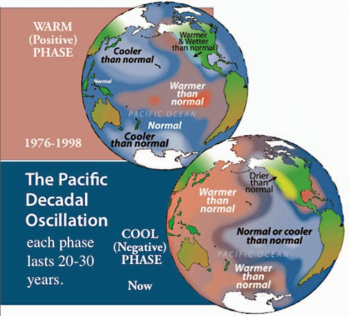
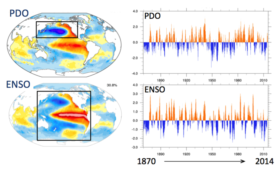
Pacific Decadal Oscillation
- A phenomenon that makes cyclones more frequent by combining global warming and the Pacific Decadal Oscillation (PDO).
- Basically, it is a long-term ocean fluctuation in the Pacific Ocean.
- Negative PDO, when encountered in the La Nina phase, creates suitable conditions for tropical cyclones.
- PDO entered a cooler or negative phase in 2019.
- The oscillation has two phases-
- Cool or Negative Phase in which the Eastern Equatorial Pacific has lower than normal sea surface temperatures.
- Warm or Positive phase in which the Western Pacific Ocean has higher than normal sea surface temperatures.
Blue Hole
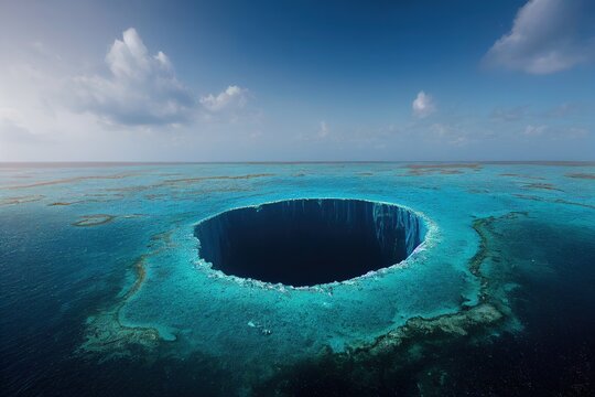
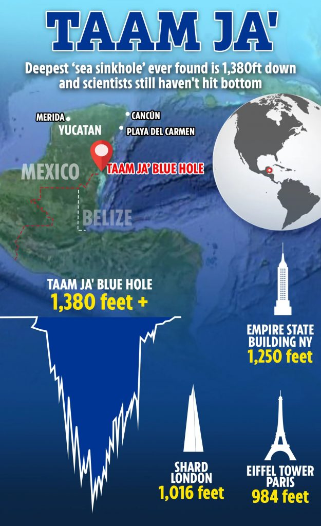
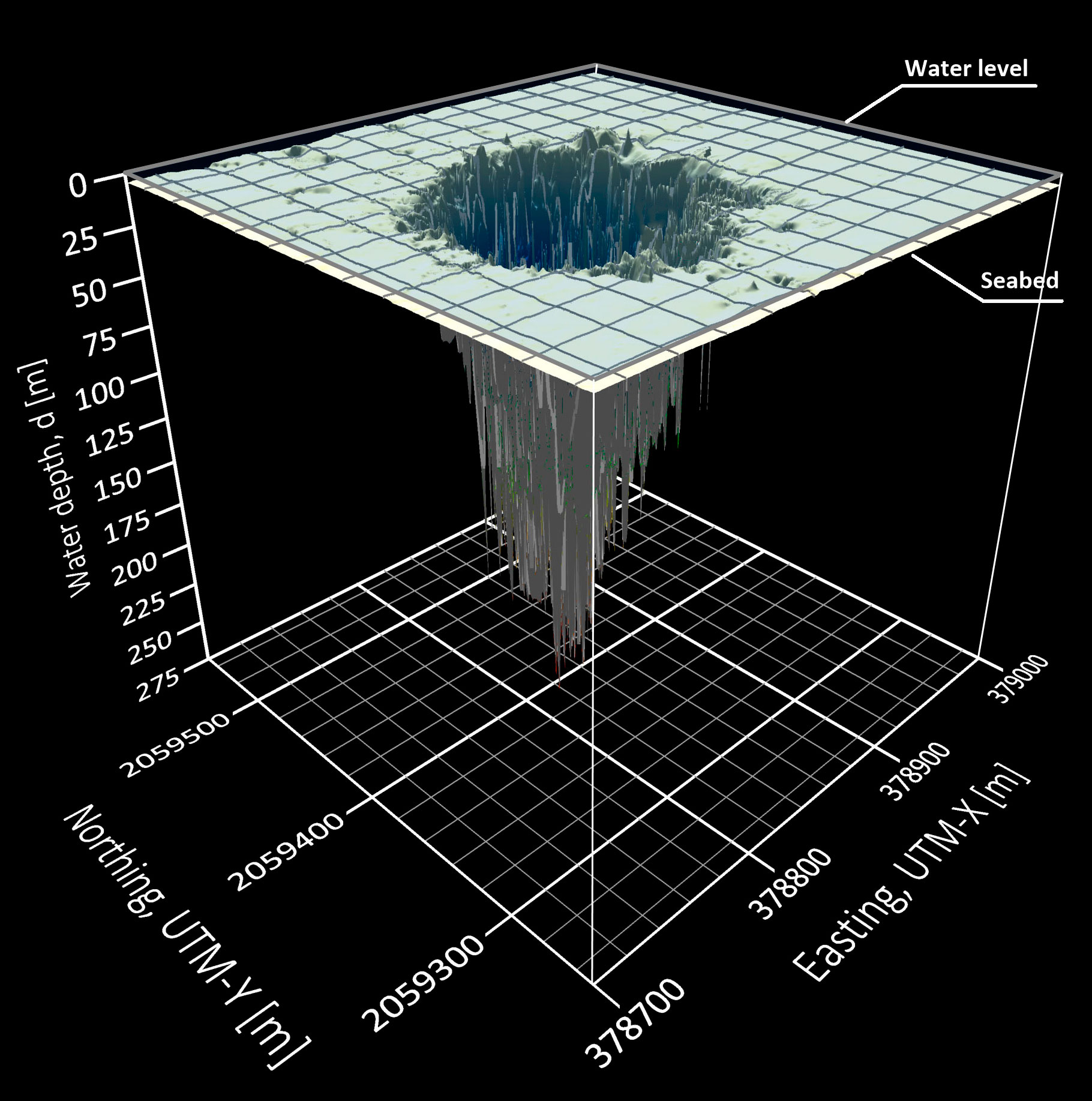
- Blue Hole is a massive underwater sinkhole recently discovered off the coast of the Yucatan Peninsula in Mexico.
- It is believed to have formed during the Ice Age when the sea level was 100–120 m lower than it is today.
- It is a microbial biodiversity hotspot and gets its name due to indigo centres and light blue perimeters.
- It is the deepest blue hole on Earth.
WISE Report
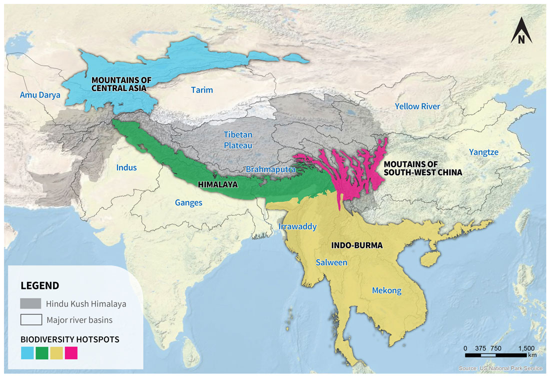
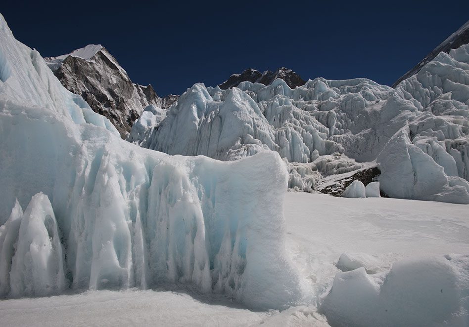
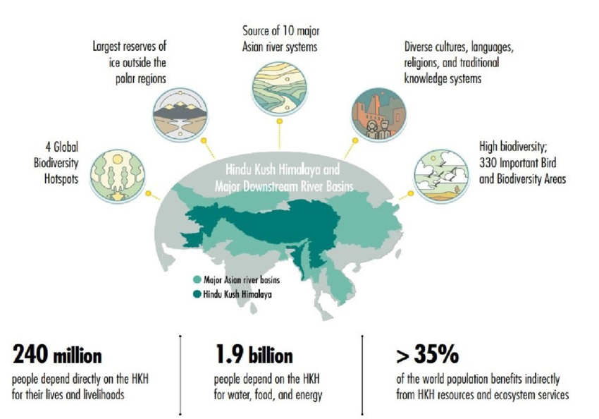
- The Water, Ice, Society, and Ecosystems (WISE) report for the Hindu Kush Himalaya was released by the International Centre for Integrated Mountain Development (ICIMOD).
- It reveals that glaciers disappeared 65% faster in the 2010s than in the last decade.
- The accelerated glacier melt means that the ‘peak water’ stage (the supply of fresh snow water due to glacier melt is the highest ever) will reach around mid-century and decrease.
- ICIMOD is an intergovernmental organization that focuses on climate and environmental risks, green economies, and sustainable action.
- The members include Afghanistan, Bangladesh, Bhutan, China, India, Myanmar, Nepal, and Pakistan.

Atlantification
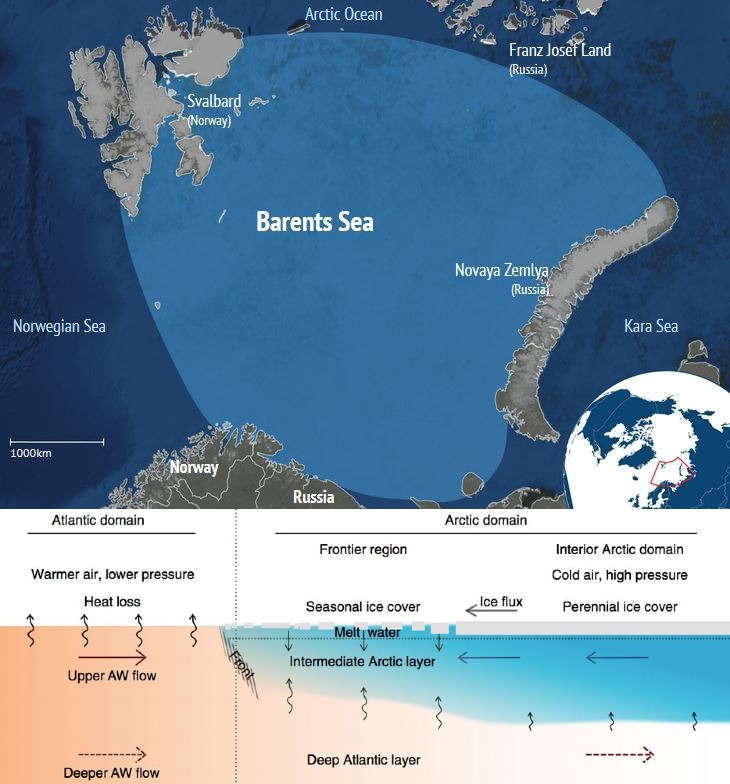
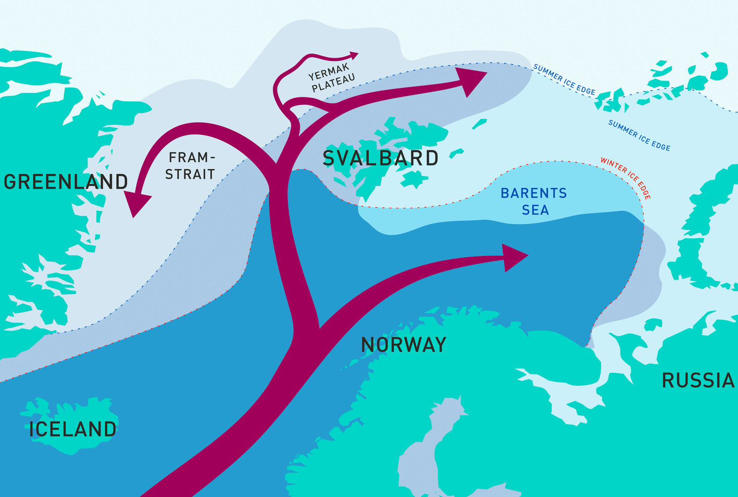
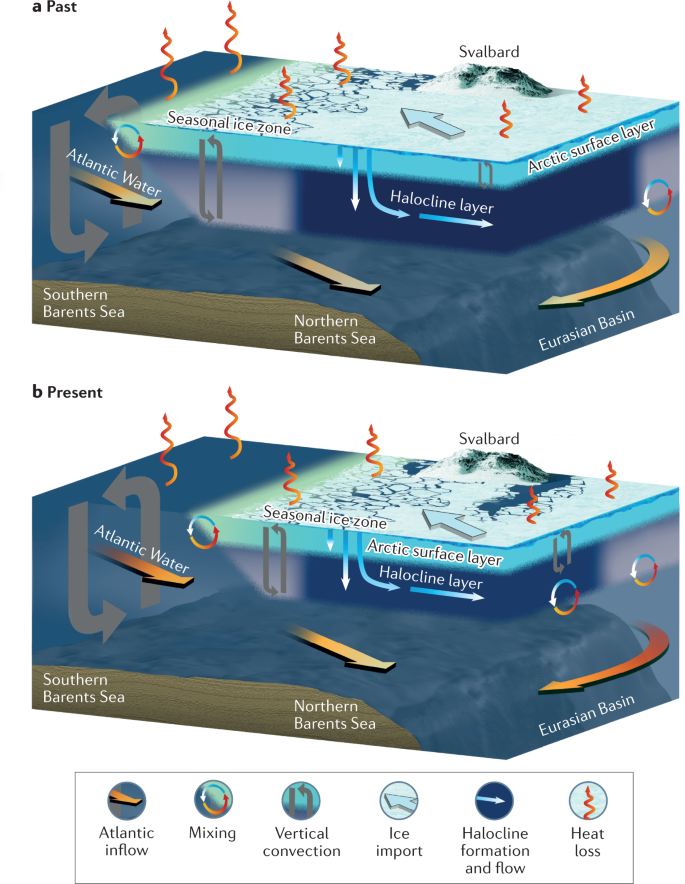
- When Arctic Ocean water becomes saltier and warmer, it is known as Atlantification.
- This occurs when warm water from the Atlantic Ocean is advected into the Arctic Ocean in increasing amounts.
- The Barents Sea is a marginal water body in the Arctic Ocean that is starting to resemble the Atlantic Ocean.
- The top of the Arctic Ocean is covered by sea ice, but below this layer, freshwater and a deeper layer of warmer, saltier water are delivered to the Arctic from the Atlantic Ocean.
- The main driving force behind this occurrence is the process called Arctic Dipole.
Shelf Cloud
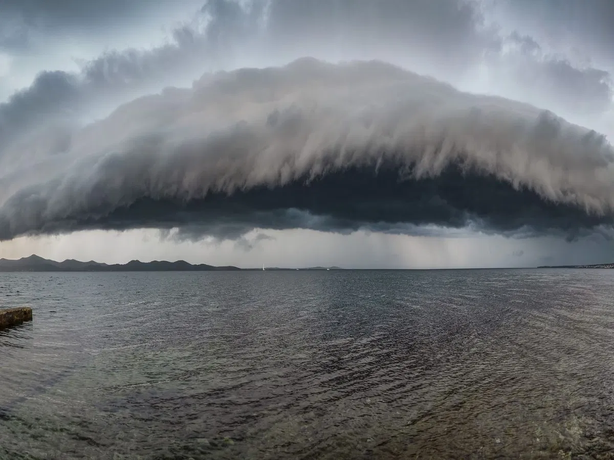
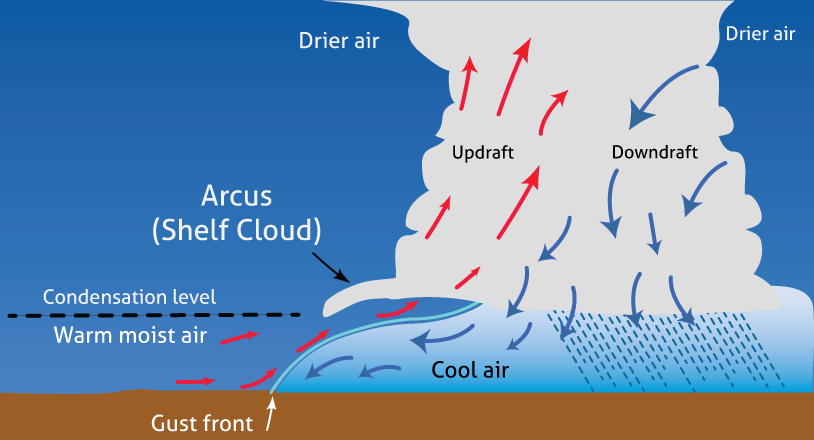
- Shelf clouds, also known as Arcus clouds, were recently seen in Uttarakhand.
- They are associated with powerful storm systems, commonly known as wall clouds, rotation clouds or funnel clouds.
- The mechanism for their formation includes a cold downdraft from a cumulonimbus cloud reaching the ground and the rapid spreading of cold air along the ground, which pushes the warm, moist air upwards.
- There are times when they are seen below the cumulonimbus clouds as dense and towering vertical clouds, causing intense rain.
- Rising air condenses the water vapour into the patterns associated with shelf clouds.
Indian Ocean Geoid Low

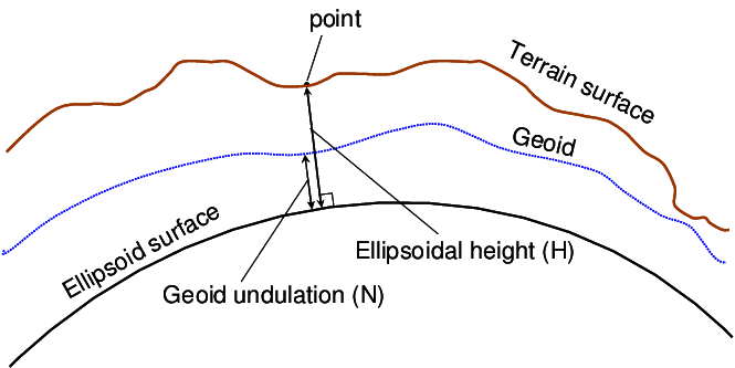
- A geoid is a ‘gravity hole’ having anomalies on Earth's map, and the Indian Ocean Geoid Low (IOGL) is an approximately three million square kilometres-wide gravity hole in the Indian Ocean.
- It is located just south of Sri Lanka because the Earth’s gravitational pull is weakest there. It is also the lowest geoid on Earth.
- The sea level is also 100 meters lower than the global average sea level.
- This is caused due to rising plumes of molten rock along the edges of Tethys Ocean bed.
Khazan Land
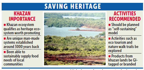
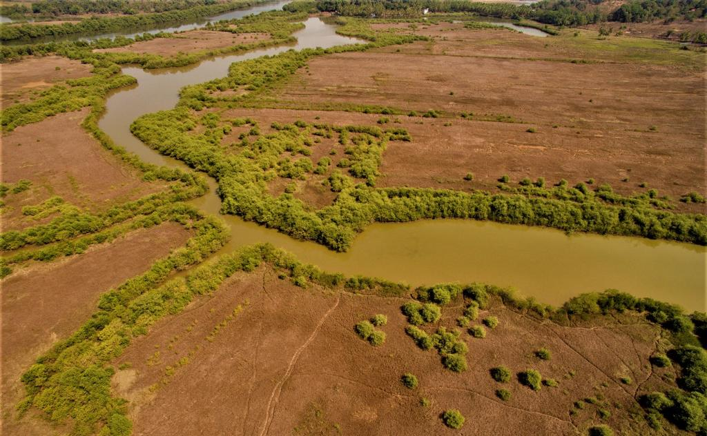
- Khazan Land is a stretch of low-lying, saline, water-logged coastal wetlands of Goa influenced by tidal flows.
- The estuarine agricultural system called Khazan farming is a carefully topo-hydro-engineered agro-aquaculture ecosystem based on the regulation of salinity and tides.
- It has an important role in the ecosystem, serving as the main drainage system for floodwater.
- It is reclaimed from mangrove forests through an intricate system of sluice gates, dykes and canals.
- The Salim Ali Bird Sanctuary in the low-lying floodplains of Goa is an important example.
Aurora
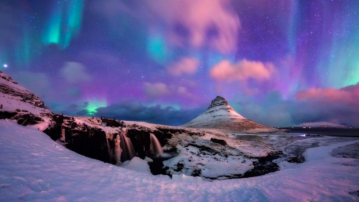


- It was documented at Mount Saraswati in the Hanle Valley of Changthang, Ladakh, by the Indian Astronomical Observatory.
- They are usually visible near poles at any time of day but can be seen only at night with the naked eye.
- Auroras are patterns of bright lights in the sky caused by the interaction of particles ejected by the Sun during coronal mass ejection with the magnetic field around the Earth.
- The shape of Earth's magnetic field contributes to the creation of auroras, which are of two types-
- Northern lights (Aurora borealis) in the Northern Hemisphere
- Southern lights (Aurora australis) in the Southern Hemisphere
Omega Blocking
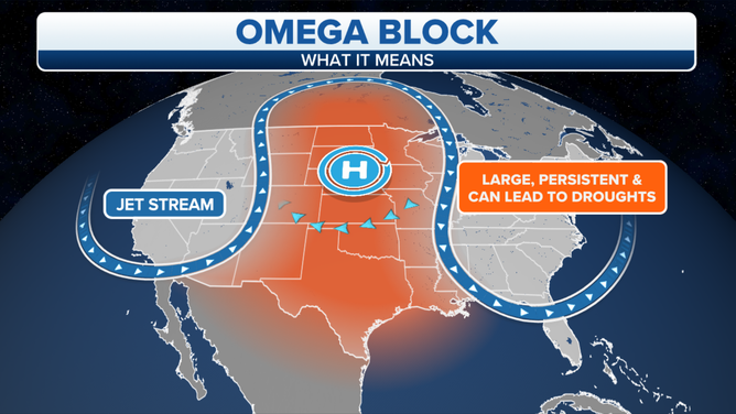
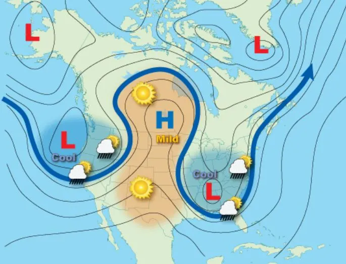
- After the recent floods in the Mediterranean region, a low-pressure system shaped like an Omega Block formed over the Netherlands.
- They are also linked to heatwaves when a high-pressure pattern blocks and diverts the jet stream due to which a mass of hot air flows up from northern Africa and the Iberian peninsula.
- When two low-pressure systems are cut off from the main flow of the jet stream and a high-pressure system is sandwiched between them, the structure resembles Ω.
- This event is linked to other extreme events such as heatwaves in France & Germany, Pakistan floods, etc.